Membership renewals open for 2024 - Click here

National

Using Airborne Gravimetry Data To Improve The Australian Model Of Zero Heights

Wednesday, April 7, 2021
1600 AEST
1700 AEST

Using Airborne Gravimetry Data To Improve The Australian Model Of Zero Heights

Presenter name & affiliations / institution: Dr Jack McCubbine, Geoscience Australia.

Abstract: In 2017, a new Australian quasigeoid model (AGQG2017) was released, with an accompanying map of uncertainty values. The model was determined from the national terrestrial gravity database and satellite altimetry derived gravity anomalies. The coverage and reliability of these data limit the accuracy of the quasigeoid model to 5 - 8 cm. However, users of the model require a reference surface which is accurate to 4 cm, or better. Geoscience Australia has partnered with, The South Australian Department of Planning, Transport and Infrastructure, The Surveyor-General Victoria within the Department of Land Water and Planning and The Geological Survey of Victoria within the Department of Jobs, Precincts and Regions to capture airborne gravity data over Greater Adelaide, Greater Melbourne and Eastern Victoria Highlands, to improve the quasigeoid model and to advance geophysical modelling.

Bio: In 2016, Jack was awarded a PhD in Geophysics from Victoria University of Wellington for his work on the collection of a national wide airborne gravity dataset, producing a new series of national gravity grids, and a new quasigeoid model for New Zealand. Following this, he came to work at Curtin University, as a post doc, working on the development of a new Australian quasigeoid model with uncertainty estimates. Jack later moved to work at GA in the National Geodesy section, to assist with the geodetic absolute gravity program and to continue to refine the national quasigeoid model.

More information can be found here: https://www.land.vic.gov.au/surveying/geodesy/airborne-gravity-survey

To register, use the following link: https://us02web.zoom.us/webinar/register/WN_gyOaiZS-RwWMQh2DJBD2aQ


Helping explorers find the nuggets in precompetitive

Tuesday, March 16, 2021
1200 (AEDT)
1300 (AEDT)

Helping explorers find the nuggets in precompetitive

Join us for David Upton from Precompetitive Review speaking on March 16, 2021 at 12:00 PM (AEDT).

Abstract: Australian precompetitive data and research is having a big impact on mineral discovery in Australia, but it could be doing so much more. We can’t blame this on governments —funding support at federal and state levels is strong. And we can’t blame it in our public geoscientists and academics, who keep on delivering innovative, clever and industry-relevant work. The biggest barrier is a failure by more explorers to seize the opportunities in precompetitive data and research. They can’t be blamed for that either because keeping on top of precompetitive data and research is not easy. Precompetitive Review was launched last year to help the public sector share its work and translate precompetitive data and research into ideas industry can act upon.

Biography: David completed a BSc in Geology at Flinders University in 1985, but chose to write about resources rather than look for them. After several years as a business journalist, including a stint at the SMH/Age in Sydney, he veered off into the murky world of public relations, working for banks, accounting firms and management consultants. David came to his senses in 2007 when he started writing again about mineral exploration. A self-published book released in 2010, The Olympic Dam Story, sparked a fascination with big exploration concepts and the unappreciated value of precompetitive data and research. A decade later, David began publishing Precompetitive Review.

To register, please click here.

ASEG NT - Interpreting high-resolution aeromagnetic data to aid mapping undercover and structural analysis of the Tanami Region and northwest Aileron Province

Tuesday, March 23, 2021
1600
1700

We have a new webinar on Wednesday 23 March, 4pm AEDT NT is bringing you a talk by Teagan Blaikie and Helen McFarlane of CSIRO on Interpreting high-resolution aeromagnetic data to aid mapping undercover and structural analysis of the Tanami Region and northwest Aileron Province.

Register now: https://us02web.zoom.us/webinar/register/WN_Q4dRbOExQEuiV8tHkm9CKA

Webinar - Geological Knowledge Discovery using Machine Augmented Intelligence.

Thursday, January 28, 2021
1300 AEDT
1400 AEDT

We have another exciting year of ASEG webinars kicking off next week with a new webinar on Thursday 28 January, 1pm AEDT by Professor Eun-Jung Holden from the University of Western Australia on Geological Knowledge Discovery using Machine Augmented Intelligence.

Geological interpretation is a complex task where an interpreter’s bias plays an important role. As a result, interpretation outcomes are variable and uncertain, but nevertheless, these outcomes form the basis of decisions with significant environmental, social and financial implications. With the increasing use of artificial intelligence and machine learning in our daily lives such as for information search, online shopping, and virtual assistant AI, the geoscience domain has also been active in the uptake of machine learning and AI to assist in interpreting geology from data.

This talk presents innovative machine-assisted technologies that improve the efficiency and the robustness of geological interpretation of different types of geodata used in the resource industry. A number of applications of machine learning were developed in collaboration with the mining industry for the analysis and integration of multi-modal drill hole data. These applications integrate the algorithms and workflows to assist human decisions. The approach is to provide end users the control of the algorithmic process as much as possible; and to enable a seamless integration of algorithms in the interpreter’s workflow using interactive visualisation. This talk also presents an on-going AI research that extracts geological insights from documents using machine reading of text. It applies advanced text mining methods and constructs a graph based knowledge base called a knowledge graph to store and access geological information. Case studies on different mineral deposits demonstrate the effectiveness of the methods for rapidly and robustly transforming text data into structured information that faithfully represents the contents of the source reports.

Bio:

Professor Holden received her BSc, MSc and PhD in computer science from the University of Western Australia.  Her postgraduate and postdoctoral research focused on developing visualisation, automated image analysis and machine learning techniques for hand gesture recognition.  Then in 2006, she made a transition to geoscience and currently leads the Geodata Algorithms Team at UWA.  The team effectively spans the boundaries of computational science and geoscience and links academia and industry.  The team’s research resulted in the commercialisation of three software products, namely CET Grid Analysis and CET Porphyry Detection extensions for Oasis Monaj; and televiewer image analysis methods in the Image & Structure Interpretation workspace for ALT’s WellCAD.  These products had significant uptake by the resource industry globally.   Recently, their research also resulted in two industry driven patents on machine assisted drillhole data interpretation methods.  Professor Holden currently leads a major industry funded research engagement named the UWA-Rio Tinto Iron Ore Data Fusion Projects.  Her team won the UWA Vice Chancellor Award in Impact and Innovation in 2015 and she was a winner of the Women in Technology in WA (WiTWA) Tech [+] 20 Awards in 2019.


Register now: https://us02web.zoom.us/webinar/register/WN_f-K3VeVKTfiuHWiXBJf65g  

WA Webinar CASE STUDY : Efficient exploration in the Bonaparte Basin Using Unstructured Data Analytics with ElasticDocs
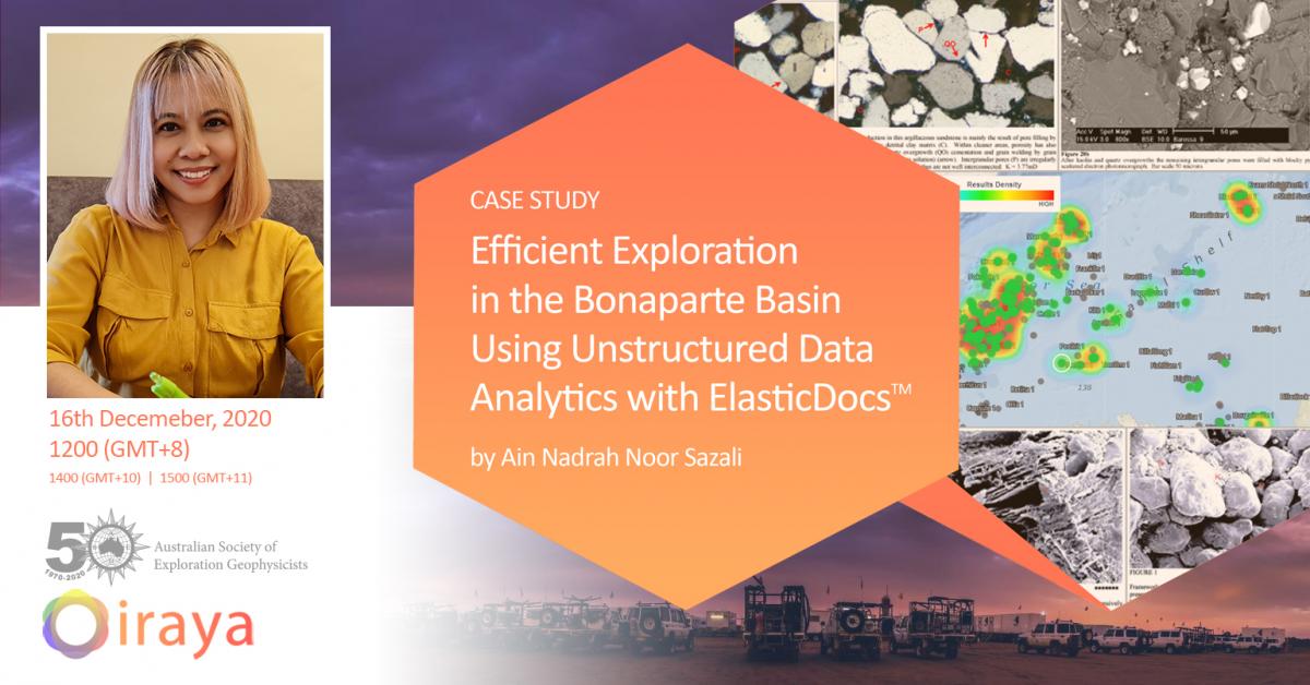
Wednesday, December 16, 2020
1200 AWST
1300 AWST

Presenter: Ain Nadrah Noor Sazali, Iraya Energies

Title: CASE STUDY :  Efficient exploration in the Bonaparte Basin Using Unstructured Data Analytics with ElasticDocs

Abstract:

Mining and Oil and Gas companies are awash with data from many different disciplines, the amount of data is growing exponentially and is estimated to double every 12 to 18 months. The diversity of the available data is such that it is impossible for any single user to efficiently access this information and knowledge. In recent years, these industries have been turning to finding new ways of tackling this challenge, using Big Data and Machine Learning technologies. In Iraya, we have developed ElasticDocsTM,  an intuitive knowledge container, capable of automatically ingesting and structuring reports, images and presentation using machine learning.

We will present a case study covering the entire Bonaparte Basin for Play Based Exploration (here, for Oil and Gas potential).The technology will be used to address the five most common potential challenges during a geological study: (i) Discrepancies in formation tops, (ii) Limited understanding of lithology distribution, (iii) Limited mineral composition understanding, (iv) Fluid distribution, (v) Pressure/temperature patterns. We will demonstrate how such analysis can be conducted in ElasticDocs and how much time and resources are saved by the geoscientist mining these vast amounts of unstructured data such as reports (G&G, drilling, production), presentations (studies, analysis, summaries), images (cores, thin sections), spreadsheets and tables.

Bio:
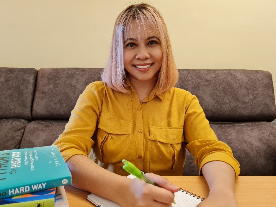
Ain Nadrah Noor Sazali is a Digital Earth Scientist in Iraya Energies. With her diverse background of domain expertise (geology, petrophysics) and  also in Data Science, she designs and deploys innovative machine learning and artificial intelligence solutions for unstructured data using ElasticDocs to support the geoscientists and engineers decision making. She holds a MSc in Petroleum Geology, a BSc in Industrial andComputational Mathematics, and a Diploma in Science Physics.

Registration: https://us02web.zoom.us/webinar/register/WN_5ncAhPosQSiGWO-b-JP8Vw

Webinar: Exploring for minerals, not anomalies: Developing quantitative interpretations of MT models. Dr Kate Selway, Macquarie University

Thursday, February 25, 2021
1300 AEDT
1400 AEDT

1pm AEDT February 16th,

Dr Kate Selway, Macquarie University.

Title: Exploring for minerals, not anomalies: Developing quantitative interpretations of MT models.

Abstract: Exploration geophysicists are well acquainted with making quantitative interpretations of near-surface geophysical data. There is a good understanding of how shallow anomalies in potential field, resistivity or EM datasets relate to mineralisation. However, as exploration models begin to include the lower crust and the lithospheric mantle, there remain significant gaps in our interpretation of deeper geophysical data. In this talk, I will highlight some new advances in our ability to produce quantitative interpretations of these deeper geophysical data, with a particular focus on MT and its joint interpretation with seismics. I will show the newly released software 'MATE', which allows MT models to be interpreted in terms of temperature and composition, and discuss new results from the Eastern Goldfields Superterrane of the Yilgarn Craton, which show how quantitatively interpreted MT models can feed into improved exploration strategies.

Bio: Dr Kate Selway is a geophysicist and researcher who specialises in the MT method and improving interpretations of mantle geophysics. She recently completed an ARC Future Fellowship based at Macquarie University and has previously held research positions at the University of Oslo, Lamont-Doherty Earth Observatory, Yale University and the University of Adelaide, after completing her PhD at the University of Adelaide in 2007. Her research has spanned giant mineral deposits in Australia, active rifting in East Africa, and mantle uplift in Greenland and Antarctica.

https://us02web.zoom.us/webinar/register/WN_OPdMzdnaQbapkiVh7a4ViQ

Webinar - Seismic imaging of the crust using Bayesian joint Inversion of teleseismic P-wave coda autocorrelation waveforms.

Tuesday, February 2, 2021
1230 AWST
1330 AWST

On Tuesday 2 February, 3:30pm AEDT FedEx is bringing you a talk by Dr Mehdi Tork Qashqai from the CSIRO on Seismic imaging of the crust using Bayesian joint Inversion of teleseismic P-wave coda autocorrelation waveforms.

Deep crustal-scale structures are critical for controlling and development of a wide range of mineral deposits. Incoming seismic waves generated from teleseismic earthquakes can be used to image the deep crustal structures. Traveltimes of the teleseismic P and mode-converted S-waves and their reverberations place a tight constraint on the Vp/Vs ratio, and their amplitude ratio provides tight bounds on the P and S wave velocity jumps across the main discontinuities/boundaries in the subsurface structure below a seismic receiver. Teleseismic P-to-S converted waveforms have been used for decades to estimate the shear-wave velocity of the subsurface and depths of major discontinuities below a seismic receiver through a method known as the P receiver functions. In this presentation, a new and alternative approach is presented. Waveforms associated with the P and all mode-converted shear waves are extracted by the autocorrelation of the teleseismic P-wave coda recorded on the radial and vertical component of a three-component receiver. Then, these waveforms are jointly inverted using a probabilistic joint inversion framework to simultaneously estimate seismic properties of the crust (Vp, Vs and Vp/Vs). This approach is particularly useful when there are no high-quality and reliable receiver function waveforms. This approach is cost-effective and can be used in conjunction with the inversion of receiver function, or the deep active seismic reflection profiling to obtain additional/complementary information on the subsurface structure, especially at middle and lower crustal depths where the deep seismic reflection method has penetration problem. In this presentation, I will show some synthetic and real data examples to confirm the feasibility of this imaging technique and also to encourage further application of this approach.


Bio:

In November 2012, Mehdi joined the PhD program at Geodynamic and Geophysics group at Macquarie university in Sydney, Australia. His research focused on the development and implementation of a multi-parameter geophysical inverse modelling tool known as “LitMod”. In August 2016, Mehdi completed his PhD thesis entitled “Multi-observable Probabilistic Inversion for the Thermochemical Structure of the Lithosphere". Prior to his doctoral study, he was working in the oil and gas exploration industry for 6 years as a seismic processing and team leader geophysicist, delivering processing, imaging, and quantitative interpretation of seismic data. He joined the CSIRO Deep Earth Imaging Future Science Platform (DEI FSP) in July 2017 as a postdoctoral fellow. He is currently a research scientist at CSIRO DEI FSP and his main research in the “Geoscience Imaging” pillar of the DEI research is focused on the developing and application of new passive seismic imaging approaches to obtain better tomographic models of subsurface structure across multiple scales (e.g., from exploration-scale to lithospheric-scale). 


Register now: https://us02web.zoom.us/webinar/register/WN_JKe1Im6oSTmmBSh9h7EnSg

GA’s new geophysical archive and data delivery system: GADDS 2.0

Wednesday, December 9, 2020
1530 AEDT
1630 AEDT

On Tuesday 9 December, 3:30pm AEDT the ACT branch is bringing us a talk by Simon van der Wielen on GA’s new geophysical archive and data delivery system: GADDS 2.0

Geoscience Australia’s Geophysical Archive Data Delivery System (GADDS) brings magnetic, radiometric, gravity and digital elevation data from Australian National, State and Territory Government geophysical data archives together into a single location.

As the current platform on which GADDS resides is reaching the end of its life, Geoscience Australia has been preparing to migrate to a new platform. Following a period of testing, the system will be officially released in December 2020. The new platform offers users a simpler and faster experience with greater flexibility over form and size of data delivery. Over time, the platform will also offer access to a broader range of data including multi-variable datasets such as airborne EM and airborne gravity and gradiometry.

The migration of this platform primarily supports Geoscience Australia’s enabling an informed Australia priority area.

Register now: https://us02web.zoom.us/webinar/register/WN_7sEBLy1ATmmtZq1ZtcN99A

NSW student night presentations

Wednesday, November 18, 2020
1800
1900
Wednesday, 18th November, 6-7pm
 
NSW student night, presenters: 
 

- Tom Zhao (UNSW) – NSW student scholarship winner

- Kelly Vaughan-Taylor (Macquarie Uni)

- Sue Chan (Uni of Sydney) 

 
More details to follow!   
 
To register, please use the following link: https://us02web.zoom.us/webinar/register/WN_3M3CXGfHTkmU3cNEru1qUw

ASEG WA Webinar: Pre-stack Depth Imaging: Challenges in exploration-scale volcanic geobody model-building in the Potiguar Basin, Brazil

Tuesday, November 10, 2020
1500 (AWST)
1600 (AWST)

Pre-stack Depth Imaging: Challenges in exploration-scale volcanic geobody model-building in the Potiguar Basin, Brazil

Rich Bartlett, Shearwater GeoServices

Register here: https://us02web.zoom.us/webinar/register/WN_PRBuo4cySDixmFf5QwTLMQ

The Potiguar Basin includes the largest oil-producing region in Equatorial Brazil, where production is from the syn-rift to transitional successions. The Pitu well in the deep-water offshore part of the basin found oil, gas and condensate at depths of 4,300m in Upper Aptian sands of the Alagamar and Pescada Formations.


A 10,500 km² 3D survey was acquired in 2019 and seismic processing through PSDM imaging was initiated. The presence of high velocity volcanics in the sedimentary sequence presents unique imaging challenges for Pre-Stack Depth Migration (PSDM). By their nature, volcanic geobodies have a varying thickness, velocity fill and extent, and require detailed interpretation to be represented accurately in a PSDM anisotropic model. This talk will present an iterative and efficient methodology to interpret and refine volcanic geobodies with examples from this exploration-scale PSDM survey.


Rich Bartlett, Depth Imaging Manager from Shearwater GeoServices. Rich graduated in 2002 from the University of Leeds UK and Queen's University Canada with a Masters In Geophysics. He spent his early career as a Geophysicist at Veritas DGC with various roles in the Depth Imaging teams in both London and Calgary offices, moving through the various incarnations of CGGVeritas and CGG. This was followed by 3 years consulting with Monarch Geophysical Services on a range of marine and land acquisition and processing projects before moving back to the frontline with Dolphin Geophysical in 2013, and latterly with Shearwater GeoServices. Rich has helped build Shearwater's Depth Imaging capabilities from scratch, with Shearwater now offering a wide range of inversion and imaging services behind its vessels and to the open proprietary market.


Pages